Loading...
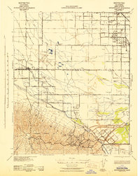
Loading map...1954 Map of Buttonwillow
USGS Topo · Published 1976About this map
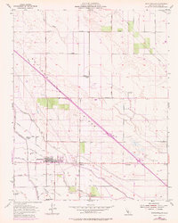
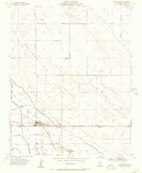
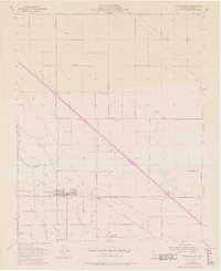
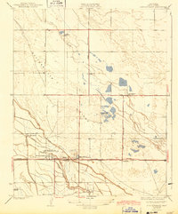
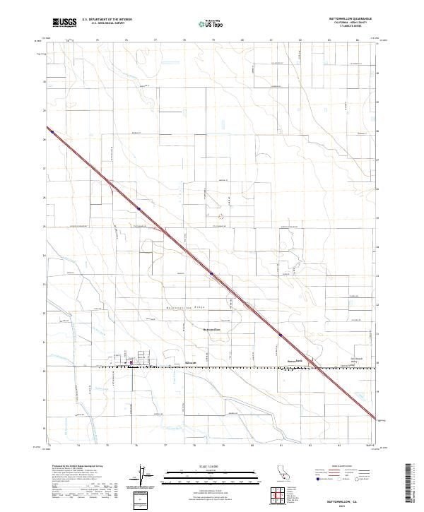
Buttonwillow sits at the heart of an intensive irrigation and petroleum landscape in the southern San Joaquin Valley, defined by a rigid grid of drainage canals and the prominent Buttonwillow Ridge. This 1954 topographic record, updated with 1973 revisions, reveals a complex network of water management features including the Riverside Ditch, Main Canal, and East Side Canal. These channels supported a series of established agricultural properties such as Palomas Ranch, Mirasol Ranch, and Deep Wells Ranch.
Find a feature on this map
34 named features on this map. Tap any name to fly to it.
Don’t see what you’re looking for? This feature index may not catch every label — zoom into the map to look around manually.
Map Details
Date Portrayed1954
Date Published1976
PublisherU.S. Geological Survey
Map TypeTopographic
Scale1:24,000
Physical Dimensions21.5 x 26.8 inches
Editions of this 1954 Buttonwillow Map
3 editions found
Historical Maps of Buttonwillow Through Time
7 maps found
Featured Locations
Source Details
SourceU.S. Geological Survey
CopyrightPublic Domain