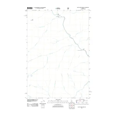
2011 Map of Butts Creek Point
USGS Topo · Published 2011About this map
The Salmon River carves a deep path through this Idaho interior, joined by the Middle Fork Salmon River in a landscape defined by significant drainage systems. Prominent bars such as Corn Creek Bar, Cunningham Bar, and Cache Bar line the river banks, reflecting the alluvial geography and historical significance of these riverside flats for transit and temporary settlement. The Salmon River Rd follows the water's edge, providing access to the Cache Bar Campground. Higher elevations are marked by landmarks like Butts Creek Point, while numerous tributaries including Kitchen Creek, Placer Creek, and Stoddard Creek create a complex network of canyons. The map serves as a detailed record of the wilderness hydrology and limited forest road infrastructure at the start of the 21st century.
Find a feature on this map
26 named features on this map. Tap any name to fly to it.
Don’t see what you’re looking for? This feature index may not catch every label — zoom into the map to look around manually.
Map Details
Editions of this 2011 Butts Creek Point Map
This is the sole edition of this map. No revisions or reprints were ever made.
Other maps of this area

1956 · Elk City
USGS Topo · 1:250,000

1960 · Elk City
USGS Topo · 1:250,000

1962 · Square Top
USGS Topo · 1:24,000

1962 · Long Tom Mtn
USGS Topo · 1:24,000

1962 · Papoose Peak
USGS Topo · 1:24,000

1962 · Aggipah Mtn
USGS Topo · 1:24,000

1962 · Mt Mc Guire
USGS Topo · 1:24,000

1962 · Horse Creek Butte
USGS Topo · 1:24,000

1962 · Butts Creek Point
USGS Topo · 1:24,000

1977 · Cottonwood Butte
USGS Topo · 1:24,000