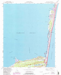
1948 Map of Buxton
USGS Topo · Published 1984About this map
The narrow elbow of Hatteras Island stands as a fragile barrier between the Atlantic Ocean and Pamlico Sound, dominated by the maritime forests of Buxton Woods. This map, updated with 1980s data over a mid-century base, reveals the shifting geography of the Outer Banks near the famous lighthouse. The transition from the old Cape Hatteras Lighthouse to its active successor is visible, reflecting the constant battle against shoreline erosion. Small coastal settlements like Avon and Buxton are connected by a single roadway corridor, while the back bays and sounds are defined by intricate waterways such as Askins Creek, Peters Ditch, and Buxton Harbor Channel. The inclusion of the Cape Hatteras National Seashore boundary highlights the area's significance as a protected landscape, even as developments like Brigand Bay and Buxton Landing appear on the sound side.
Find a feature on this map
41 named features on this map. Tap any name to fly to it.
Don’t see what you’re looking for? This feature index may not catch every label — zoom into the map to look around manually.
Map Details
Editions of this 1948 Buxton Map
4 editions found
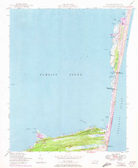
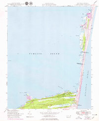
Other maps of this area

1948 · Cape Hatteras
USGS Topo · 1:24,000

1948 · Buxton
USGS Topo · 1:24,000

1950 · Cape Hatteras
USGS Topo · 1:24,000

1950 · Buxton
USGS Topo · 1:24,000

1955 · Wanchese
USGS Topo · 1:250,000

1957 · Manteo
USGS Topo · 1:250,000

1960 · Manteo
USGS Topo · 1:250,000

1985 · Cape Hatteras
USGS Topo · 1:100,000

2002 · Cape Hatteras
USGS Topo · 1:24,000

2011 · Buxton
USGS Topo · 1:24,000