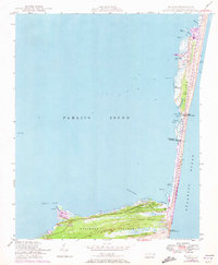
1948 Map of Buxton
USGS Topo · Published 1973About this map
Hatteras Island dominates this mid-century survey, stretching between the Atlantic Ocean and the expansive Pamlico Sound. The map reveals the critical maritime infrastructure of the Outer Banks, anchored by the Cape Hatteras Lighthouse and the Big Kinnakeet Coast Guard Sta. The settlement of Buxton serves as the gateway to Buxton Woods, while the village of Avon sits farther north along the narrow strip of sand. This edition includes revisions in purple that illustrate the dynamic nature of the shoreline, showing how the dunes and inlets shifted between the initial 1948 field check and 1970 aerial photography. Significant coastal landmarks such as Black Hammock and Jeanette Sedge underscore the fragile, water-dominated environment of the Cape Hatteras National Seashore.
Find a feature on this map
35 named features on this map. Tap any name to fly to it.
Don’t see what you’re looking for? This feature index may not catch every label — zoom into the map to look around manually.
Map Details
Editions of this 1948 Buxton Map
4 editions found
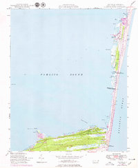
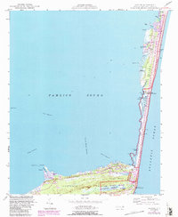
Other maps of this area

1948 · Cape Hatteras
USGS Topo · 1:24,000

1948 · Buxton
USGS Topo · 1:24,000

1950 · Cape Hatteras
USGS Topo · 1:24,000

1950 · Buxton
USGS Topo · 1:24,000

1955 · Wanchese
USGS Topo · 1:250,000

1957 · Manteo
USGS Topo · 1:250,000

1960 · Manteo
USGS Topo · 1:250,000

1985 · Cape Hatteras
USGS Topo · 1:100,000

2002 · Cape Hatteras
USGS Topo · 1:24,000

2011 · Buxton
USGS Topo · 1:24,000