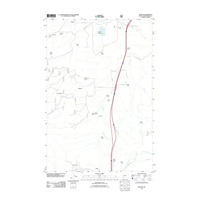
2011 Map of Buxton
USGS Topo · Published 2011About this map
Deer Lodge Pass serves as a central geographic corridor through this section of Silver Bow County, where modern infrastructure follows paths carved by the landscape's many gulches and canyons. The presence of the NW NE Section 32 Mine and the Stauffer Chemical Number 1 Dam highlights the region's industrial and resource-driven history. Transit and commerce are centered around the rail lines and sidings, specifically Silver Bow Siding and Buxton Siding, which sit near the small settlements of Buxton and Feely. The terrain is characterized by a series of drainage features, including Sunday Gulch and Pink Gulch, which flow toward Sand Creek and Silver Bow Creek. This map illustrates how the rugged topography of areas like Sunday Ridge and Park Canyon has dictated the placement of roads such as German Gulch Rd and Battle Ridge Rd.
Find a feature on this map
47 named features on this map. Tap any name to fly to it.
Don’t see what you’re looking for? This feature index may not catch every label — zoom into the map to look around manually.
Map Details
Editions of this 2011 Buxton Map
This is the sole edition of this map. No revisions or reprints were ever made.
Other maps of this area

1889 · Helena
USGS Topo · 1:250,000

1893 · Helena
USGS Topo · 1:250,000

1893 · Dillon
USGS Topo · 1:250,000

1899 · Helena
USGS Topo · 1:250,000

1903 · Helena
USGS Topo · 1:250,000

1947 · Butte
USGS Topo · 1:250,000

1955 · Dillon
USGS Topo · 1:250,000

1957 · Dillon
USGS Topo · 1:250,000

1958 · Butte
USGS Topo · 1:250,000

1958 · Dillon
USGS Topo · 1:250,000