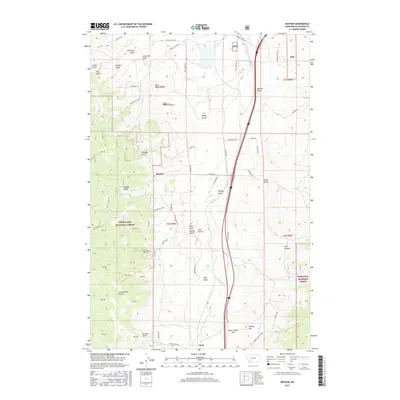
2017 Map of Buxton
USGS Topo · Published 2017About this map
Deerlodge National Forest dominates the western half of this landscape, where the Continental Divide crests near the high ground of Sunday Ridge. The terrain is defined by a dense network of drainages and gulches, including McCleery, Orchard, and Price, which feed into lower valleys. In the east, the transportation corridor follows the path of Sand Creek, punctuated by the small settlements of Buxton and Feely. This area serves as a critical transition point across the mountains, evidenced by the presence of Deer Lodge Pass and the S Buxton Frontage Rd. The map also captures several named landmarks such as Feeley Hill and Park Canyon, alongside local land features like the Morris Angus Ranch. The spatial layout reveals how human transit routes, such as the Pronghorn Trail, have historically conformed to the rugged topography of the Divide.
Find a feature on this map
72 named features on this map. Tap any name to fly to it.
Don’t see what you’re looking for? This feature index may not catch every label — zoom into the map to look around manually.
Map Details
Editions of this 2017 Buxton Map
This is the sole edition of this map. No revisions or reprints were ever made.
Other maps of this area

1889 · Helena
USGS Topo · 1:250,000

1893 · Helena
USGS Topo · 1:250,000

1893 · Dillon
USGS Topo · 1:250,000

1899 · Helena
USGS Topo · 1:250,000

1903 · Helena
USGS Topo · 1:250,000

1947 · Butte
USGS Topo · 1:250,000

1955 · Dillon
USGS Topo · 1:250,000

1957 · Dillon
USGS Topo · 1:250,000

1958 · Butte
USGS Topo · 1:250,000

1958 · Dillon
USGS Topo · 1:250,000