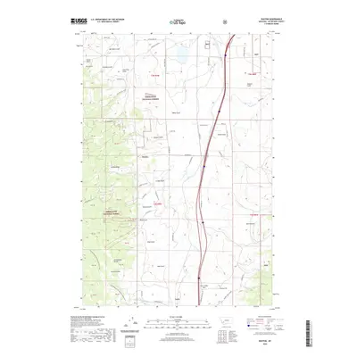
2020 Map of Buxton
USGS Topo · Published 2020About this map
Buxton and Feely sit along a transport corridor in the high country of Silver Bow County, where the landscape is defined by the steep transition toward the Continental Divide. The terrain is deeply incised by a network of drainage features such as German Gulch and Seven Springs Cr, which flow through the eastern reaches of the Deerlodge National Forest. This 2020 record of the area highlights the persistent importance of natural landmarks like Deer Lodge Pass and Sunday Ridge in guiding movement across the mountainous divide. Local land use is characterized by a mix of forestry, ranching at sites like the Morris Angus Ranch, and outdoor recreation along the Continental Divide National Scenic Trail. The map provides a precise look at the rural road network, including S Buxton Rd and Divide Creek Rd, that connects these isolated settlements.
Find a feature on this map
56 named features on this map. Tap any name to fly to it.
Don’t see what you’re looking for? This feature index may not catch every label — zoom into the map to look around manually.
Map Details
Editions of this 2020 Buxton Map
This is the sole edition of this map. No revisions or reprints were ever made.
Other maps of this area

1889 · Helena
USGS Topo · 1:250,000

1893 · Helena
USGS Topo · 1:250,000

1893 · Dillon
USGS Topo · 1:250,000

1899 · Helena
USGS Topo · 1:250,000

1903 · Helena
USGS Topo · 1:250,000

1947 · Butte
USGS Topo · 1:250,000

1955 · Dillon
USGS Topo · 1:250,000

1957 · Dillon
USGS Topo · 1:250,000

1958 · Butte
USGS Topo · 1:250,000

1958 · Dillon
USGS Topo · 1:250,000