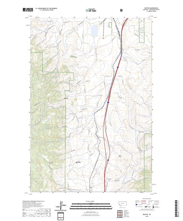
2024 Map of Buxton
USGS Topo · Published 2024About this map
Deerlodge National Forest covers much of this high-elevation landscape, where the Continental Divide winds through the southwestern corner. The settlement of Buxton sits at the base of Sunday Ridge, while Feely is positioned further south near Feeley Hill. This area is defined by its drainage patterns and the historic transit corridor passing through Deer Lodge Pass. Numerous gulches such as Sunday Gulch, Price Gulch, and Hanson Gulch carve into the terrain, indicating a complex watershed that feeds into Seven Springs Creek and East Fork Divide Creek. For those tracing the evolution of Montana trail systems, the map shows the modern path of the Continental Divide National Scenic Trail as it traverses the ridges and passes. Rural life is anchored by landmarks like the Morris Angus Ranch and crossings like Miles Xing.
Find a feature on this map
73 named features on this map. Tap any name to fly to it.
Don’t see what you’re looking for? This feature index may not catch every label — zoom into the map to look around manually.
Map Details
Editions of this 2024 Buxton Map
This is the sole edition of this map. No revisions or reprints were ever made.
Other maps of this area

1889 · Helena
USGS Topo · 1:250,000

1893 · Helena
USGS Topo · 1:250,000

1893 · Dillon
USGS Topo · 1:250,000

1899 · Helena
USGS Topo · 1:250,000

1903 · Helena
USGS Topo · 1:250,000

1947 · Butte
USGS Topo · 1:250,000

1955 · Dillon
USGS Topo · 1:250,000

1957 · Dillon
USGS Topo · 1:250,000

1958 · Butte
USGS Topo · 1:250,000

1958 · Dillon
USGS Topo · 1:250,000