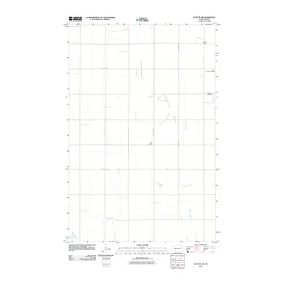
2011 Map of Buxton SW
USGS Topo · Published 2011About this map
Asheim Cemetery and West Immanuel Cemetery stand as quiet landmarks in this rural corner of Traill County, reflecting the deep-rooted settlement patterns of the Red River Valley. The landscape is defined by the grid-like progression of section lines and gravel routes such as County Hwy-21 and County Hwy-10, which carve through the fertile prairie. Natural drainage follows the meandering path of the North Branch Goose River in the southwest and Buffalo Coulee to the southeast, features that have historically influenced homestead placement. Genealogists will find particular value in the distribution of family and community burial sites, including the Sodeberg Cemetery and North Prairie Cemetery, which are primary markers of the area's early 20th-century social geography.
Find a feature on this map
11 named features on this map. Tap any name to fly to it.
Don’t see what you’re looking for? This feature index may not catch every label — zoom into the map to look around manually.
Map Details
Editions of this 2011 Buxton SW Map
This is the sole edition of this map. No revisions or reprints were ever made.
Other maps of this area

1918 · Kelso
USGS Topo · 1:62,500

1943 · Kelso
USGS Topo · 1:62,500

1952 · Grand Forks
USGS Topo · 1:250,000

1956 · Grand Forks
USGS Topo · 1:250,000

1963 · Hillsboro
USGS Topo · 1:24,000

1966 · Grand Forks
USGS Topo · 1:250,000

1967 · Mayville South
USGS Topo · 1:24,000
1967 · Hillsboro NW
USGS Topo · 1:24,000
1970 · Mayville North
USGS Topo · 1:24,000
1971 · Buxton SW
USGS Topo · 1:24,000