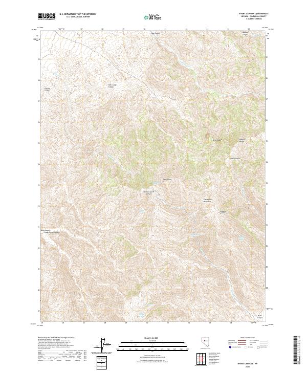
2021 Map of Byers Canyon
USGS Topo · Published 2021About this map
Clan Alpine Mountains define this high-elevation landscape in Churchill County, where dramatic elevation changes are marked by peaks like Healy Peak. The terrain is deeply incised by numerous canyons, including Augusta Canyon, Dyer Canyon, and the central Meadow Spring Canyon. This modern survey reveals a landscape where water sources remain critical identifiers for navigation and history, with named points like Deer Lodge Spring and Granite Spring scattered across the high desert slopes. The map also traces the drainage patterns of Willow Cr and Healy Cr as they flow from the steeper ridges. While the eponymous Byers Canyon sits at the southeastern edge, the map primarily documents the remote interior of the range, offering a precise view of the geographic relationships between family-named landmarks like Deer Lodge Canyon and Bernice Canyon.
Find a feature on this map
33 named features on this map. Tap any name to fly to it.
Don’t see what you’re looking for? This feature index may not catch every label — zoom into the map to look around manually.
Map Details
Editions of this 2021 Byers Canyon Map
This is the sole edition of this map. No revisions or reprints were ever made.
Other maps of this area

1955 · Millett
USGS Topo · 1:250,000

1959 · Millett
USGS Topo · 1:250,000

1966 · Clan Alpine Ranch
USGS Topo · 1:62,500

1966 · Humboldt Salt Marsh
USGS Topo · 1:62,500

1966 · Shoshone Meadows
USGS Topo · 1:62,500

1966 · Edwards Creek Valley
USGS Topo · 1:62,500

1983 · Edwards Creek Valley
USGS Topo · 1:100,000

1990 · Byers Ranch
USGS Topo · 1:24,000
1990 · Mt. Augusta
USGS Topo · 1:24,000
1990 · Bernice Canyon
USGS Topo · 1:24,000