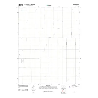
2009 Map of Byers
USGS Topo · Published 2009About this map
Byers serves as the primary population center on this central Kansas prairie landscape, situated at the intersection of a vast grid of local thoroughfares. The settlement's layout is defined by its position along NW 100th St and NW 70th Ave, reflecting the rigid agricultural survey system that governs the region's geography. Located north of the town center, the Byers Cemetery remains a significant landmark for those researching family history and local ancestry. The surrounding terrain is largely defined by the intersection of numerous county roads, including major corridors like SW 90th St and NW 40th Ave, which facilitate the movement of goods and people across the plains of Pratt County.
Find a feature on this map
21 named features on this map. Tap any name to fly to it.
Don’t see what you’re looking for? This feature index may not catch every label — zoom into the map to look around manually.
Map Details
Editions of this 2009 Byers Map
This is the sole edition of this map. No revisions or reprints were ever made.
Other maps of this area

1892 · Pratt
USGS Topo · 1:125,000

1894 · Pratt
USGS Topo · 1:125,000

1955 · Pratt
USGS Topo · 1:250,000

1959 · Pratt
USGS Topo · 1:250,000

1968 · Pratt
USGS Topo · 1:24,000

1968 · Cullison
USGS Topo · 1:24,000

1968 · Coats NE
USGS Topo · 1:24,000
1971 · Byers
USGS Topo · 1:24,000
1971 · Hopewell
USGS Topo · 1:24,000
1971 · Stafford SW
USGS Topo · 1:24,000