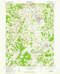
1961 Map of Byesville
USGS Topo · Published 1963About this map
Byesville serves as the industrial and social hub of this Guernsey County landscape, marked by a dense grid of streets and the Pennsylvania railroad line. The surrounding countryside in the early 1960s is heavily defined by extensive Strip Mines and several smaller coal-era settlements like Buckeyeville, Lucasburg, and Robins. Local heritage is preserved in numerous country landmarks, including Beech Grove Sch and the sprawling Greenwood Cemetery.
Find a feature on this map
50 named features on this map. Tap any name to fly to it.
Don’t see what you’re looking for? This feature index may not catch every label — zoom into the map to look around manually.
Map Details
Editions of this 1961 Byesville Map
4 editions found
Other maps of this area

1909 · Antrim
USGS Topo · 1:48,000

1909 · Summerfield
USGS Topo · 1:62,500

1909 · Cambridge
USGS Topo · 1:62,500

1911 · Antrim
USGS Topo · 1:62,500

1911 · Cumberland
USGS Topo · 1:62,500

1911 · Summerfield
USGS Topo · 1:62,500

1912 · Cambridge
USGS Topo · 1:62,500

1949 · Clarksburg
USGS Topo · 1:250,000

1951 · Canton
USGS Topo · 1:250,000

1953 · Canton
USGS Topo · 1:250,000