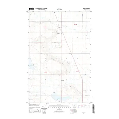
2014 Map of Bynum
USGS Topo · Published 2014About this map
Bynum serves as a central hub in this section of Teton County, situated along the agricultural corridor of the eastern Rocky Mountain Front. The landscape is defined by an intricate network of irrigation and water management, featuring Eureka Reservoir, Farmers Reservoir, and the Teton River. These water sources are managed through systems like the Farmers Ditch and Eldorado Ditch, which support the surrounding ranching and farming operations. The small settlement of Miller Colony and the rail-aligned siding at Koyl reflect the specialized agricultural and transport history of the region. Local heritage is further anchored by the Bynum Cem north of town and Ralston Gap, a notable break in the terrain to the south. This survey captures a moment when traditional land use patterns remained deeply etched in the Montana plains through family-named roads like Pilzman Rd and Guthrie Rd.
Find a feature on this map
38 named features on this map. Tap any name to fly to it.
Don’t see what you’re looking for? This feature index may not catch every label — zoom into the map to look around manually.
Map Details
Editions of this 2014 Bynum Map
This is the sole edition of this map. No revisions or reprints were ever made.
Other maps of this area

1920 · Choteau
USGS Topo · 1:125,000

1920 · Dupuyer
USGS Topo · 1:125,000

1936 · Pendroy
USGS Topo · 1:48,000

1938 · Gallup City
USGS Topo · 1:62,500

1941 · Pendroy
USGS Topo · 1:62,500

1942 · Gallup City
USGS Topo · 1:62,500

1955 · Choteau
USGS Topo · 1:250,000

1957 · Choteau
USGS Topo · 1:250,000

1958 · Choteau
USGS Topo · 1:250,000

1960 · Bynum
USGS Topo · 1:62,500