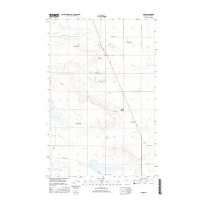
2017 Map of Bynum
USGS Topo · Published 2017About this map
Bynum serves as a central hub in this section of Teton County, where the high plains meet the engineering of the Rocky Mountain Front's water management systems. The landscape is defined by an intricate network of irrigation, including the S Canal, Eldorado Ditch, and Farmers Ditch, which redirect water from the Teton River and Muddy Cr to support local agriculture. This reliance on water rights and distribution is further evidenced by the presence of the Eureka Reservoir and Farmers Reservoir. Settled areas like Miller Colony and the community of Koyl are connected by a grid of rural routes such as Guthrie Rd and Teton Canyon Rd. Genealogists may find interest in the Bynum Cem located just east of the primary settlement, while the terrain transition at Ralston Gap provides a clear view of the area's natural geography.
Find a feature on this map
41 named features on this map. Tap any name to fly to it.
Don’t see what you’re looking for? This feature index may not catch every label — zoom into the map to look around manually.
Map Details
Editions of this 2017 Bynum Map
This is the sole edition of this map. No revisions or reprints were ever made.
Other maps of this area

1920 · Choteau
USGS Topo · 1:125,000

1920 · Dupuyer
USGS Topo · 1:125,000

1936 · Pendroy
USGS Topo · 1:48,000

1938 · Gallup City
USGS Topo · 1:62,500

1941 · Pendroy
USGS Topo · 1:62,500

1942 · Gallup City
USGS Topo · 1:62,500

1955 · Choteau
USGS Topo · 1:250,000

1957 · Choteau
USGS Topo · 1:250,000

1958 · Choteau
USGS Topo · 1:250,000

1960 · Bynum
USGS Topo · 1:62,500