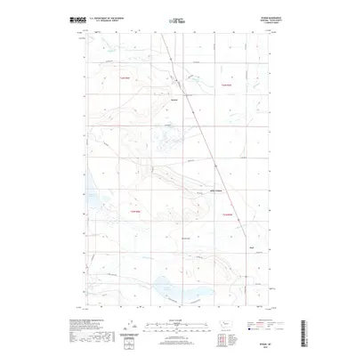
2020 Map of Bynum
USGS Topo · Published 2020About this map
The settlement of Bynum serves as a central hub in this Montana landscape, where the management of water defines the agricultural character of the region. A complex network of irrigation infrastructure, including the S Canal, D Canal, and Farmers Ditch, moves water across the terrain to support local ranching and farming. Larger bodies of water like Farmers Reservoir and Eureka Reservoir anchor the western and southern reaches of the map. The Teton River flows through the southern portion of the quadrangle, while Muddy Cr and its northern fork cross the northern sections. This 2020 record also highlights communal and family sites such as Miller Colony and Bynum Cem, alongside geological features like Ralston Gap, providing a detailed look at the rural organization of Teton County in the modern era.
Find a feature on this map
39 named features on this map. Tap any name to fly to it.
Don’t see what you’re looking for? This feature index may not catch every label — zoom into the map to look around manually.
Map Details
Editions of this 2020 Bynum Map
This is the sole edition of this map. No revisions or reprints were ever made.
Other maps of this area

1920 · Choteau
USGS Topo · 1:125,000

1920 · Dupuyer
USGS Topo · 1:125,000

1936 · Pendroy
USGS Topo · 1:48,000

1938 · Gallup City
USGS Topo · 1:62,500

1941 · Pendroy
USGS Topo · 1:62,500

1942 · Gallup City
USGS Topo · 1:62,500

1955 · Choteau
USGS Topo · 1:250,000

1957 · Choteau
USGS Topo · 1:250,000

1958 · Choteau
USGS Topo · 1:250,000

1960 · Bynum
USGS Topo · 1:62,500