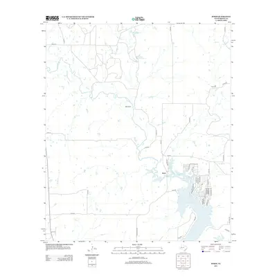
2013 Map of Byrds
USGS Topo · Published 2013About this map
Pecan Bayou and its winding tributaries, including Hog Cr and Panther Cr, dominate this central Texas landscape south of the Red River. The map centers on the small community of Byrds, positioned just north of the expansive Lake Brownwood. This 2013 survey illustrates the modern residential development along the lake’s northern shore, where a dense network of streets like Seabreeze Dr and Harbor Dr contrasts with the surrounding agricultural land.
Find a feature on this map
53 named features on this map. Tap any name to fly to it.
Don’t see what you’re looking for? This feature index may not catch every label — zoom into the map to look around manually.
Map Details
Editions of this 2013 Byrds Map
This is the sole edition of this map. No revisions or reprints were ever made.
Other maps of this area

1887 · Coleman
USGS Topo · 1:125,000

1889 · Brownwood
USGS Topo · 1:125,000

1889 · Coleman
USGS Topo · 1:125,000

1894 · Eastland
USGS Topo · 1:125,000

1894 · Brownwood
USGS Topo · 1:125,000

1924 · Coleman 1-a
USGS Topo · 1:48,000

1924 · Brownwood Reservoir Site
USGS Topo · 1:48,000

1927 · Grosvenor
USGS Topo · 1:62,500

1931 · Baird
USGS Topo · 1:125,000

1932 · Baird
USGS Topo · 1:125,000