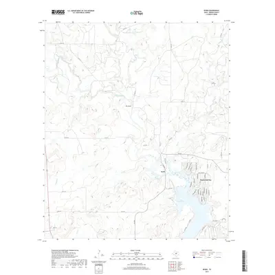
2019 Map of Byrds
USGS Topo · Published 2019About this map
Lake Brownwood dominates the southeastern quadrant of this landscape, its fingers reaching into the surrounding Texas ranch land. This modern survey illustrates the residential development around Thunderbird Bay, where a dense network of streets like Iroquois Dr and Comanche Dr meet the shoreline. Further north, the terrain is defined by the winding course of Pecan Bayou and its confluence with the Red River, creating the prominent Big Island. These waterways are managed by engineering features including Dam Number 1 and Dam Number 2. Local history and genealogy are anchored by the Lost Creek Cem located near the headwaters of Lost Cr, while the small settlement of Byrds sits at a crossroads where Hog Cr flows toward the larger lake.
Find a feature on this map
56 named features on this map. Tap any name to fly to it.
Don’t see what you’re looking for? This feature index may not catch every label — zoom into the map to look around manually.
Map Details
Editions of this 2019 Byrds Map
This is the sole edition of this map. No revisions or reprints were ever made.
Other maps of this area

1887 · Coleman
USGS Topo · 1:125,000

1889 · Brownwood
USGS Topo · 1:125,000

1889 · Coleman
USGS Topo · 1:125,000

1894 · Eastland
USGS Topo · 1:125,000

1894 · Brownwood
USGS Topo · 1:125,000

1924 · Coleman 1-a
USGS Topo · 1:48,000

1924 · Brownwood Reservoir Site
USGS Topo · 1:48,000

1927 · Grosvenor
USGS Topo · 1:62,500

1931 · Baird
USGS Topo · 1:125,000

1932 · Baird
USGS Topo · 1:125,000