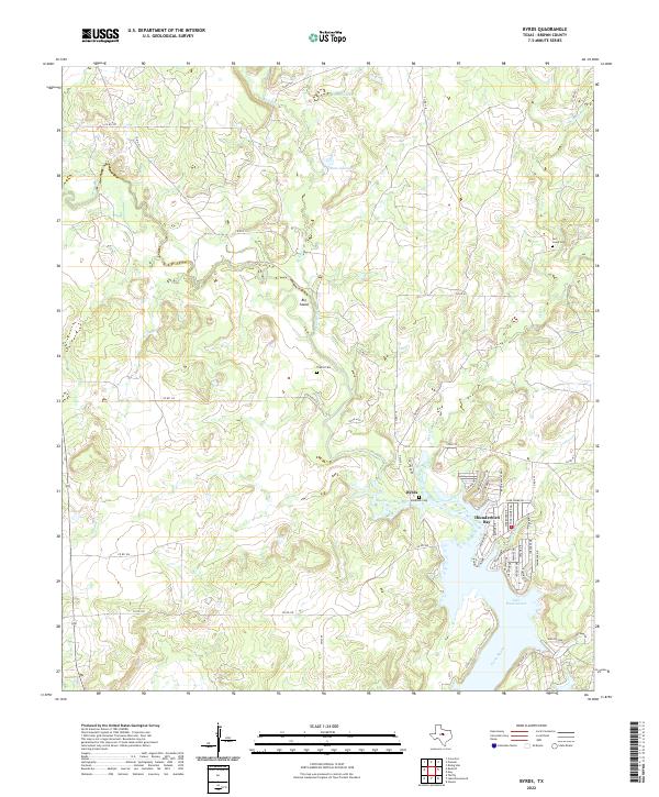
2022 Map of Byrds
USGS Topo · Published 2022About this map
Lake Brownwood dominates the southeastern quadrant of this Brown County landscape, where the waters of the Pecan Bayou meet the developed shoreline of Thunderbird Bay. This area illustrates the transformation of the Texas backcountry into a recreational and residential hub, with a dense network of suburban-style streets like Windjammer Dr and Starboard Dr contrasting against the larger rural parcels to the north. Further inland, the small community of Byrds sits near the Windham Cem, while the northern reaches are defined by a complex drainage system including the Red River and Hog Cr. Evidence of the area's pioneer roots is preserved in the scattered family and local burial grounds, such as Triplitt Cem and Lost Creek Cem. The terrain is marked by hydrological features like Big Island and seasonal waterways such as Panther Cr and Rough Br.
Find a feature on this map
58 named features on this map. Tap any name to fly to it.
Don’t see what you’re looking for? This feature index may not catch every label — zoom into the map to look around manually.
Map Details
Editions of this 2022 Byrds Map
This is the sole edition of this map. No revisions or reprints were ever made.
Other maps of this area

1887 · Coleman
USGS Topo · 1:125,000

1889 · Brownwood
USGS Topo · 1:125,000

1889 · Coleman
USGS Topo · 1:125,000

1894 · Eastland
USGS Topo · 1:125,000

1894 · Brownwood
USGS Topo · 1:125,000

1924 · Coleman 1-a
USGS Topo · 1:48,000

1924 · Brownwood Reservoir Site
USGS Topo · 1:48,000

1927 · Grosvenor
USGS Topo · 1:62,500

1931 · Baird
USGS Topo · 1:125,000

1932 · Baird
USGS Topo · 1:125,000