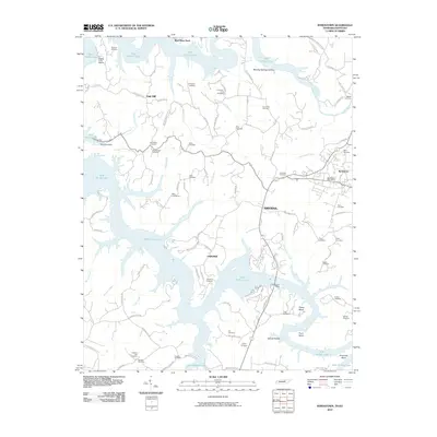
2010 Map of Byrdstown
USGS Topo · Published 2010About this map
Byrdstown serves as the focal point for this region of the Cumberland Plateau, situated just east of the irregular shoreline of Dale Hollow Lake. The landscape is defined by the deep indentations of the reservoir, where the waters of the Wolf River and numerous creeks like Brimstone Creek and Pendergrass Creek have flooded ancient valleys. Small settlements such as Smyrna, Fairview, and Oak Hill are connected by a network of ridge-running roads like Keisling Ridge Rd and Parrott Ridge Rd, reflecting a topography where travel followed the high ground between hollows. The prevalence of family and community burial grounds, including the Anderson-Jones Cemetery, Hatcher Cemetery, and Government Cemetery, offers significant detail for genealogical research, documenting the generations that inhabited these ridges before and after the creation of the lake. Modern recreational hubs such as Sunset Dock and Eagles Cove Marina highlight the area's contemporary role as a destination for water-based activities.
Find a feature on this map
106 named features on this map. Tap any name to fly to it.
Don’t see what you’re looking for? This feature index may not catch every label — zoom into the map to look around manually.
Map Details
Editions of this 2010 Byrdstown Map
This is the sole edition of this map. No revisions or reprints were ever made.
Other maps of this area

1897 · Standingstone
USGS Topo · 1:125,000

1898 · Standingstone
USGS Topo · 1:125,000

1924 · Lillydale
USGS Topo · 1:62,500

1926 · Lillydale
USGS Topo · 1:62,500

1929 · Lillydale
USGS Topo · 1:62,500

1929 · Byrdstown
USGS Topo · 1:62,500

1944 · Livingston
USGS Topo · 1:24,000

1954 · Frogue
USGS Topo · 1:24,000

1954 · Albany
USGS Topo · 1:24,000

1954 · Savage
USGS Topo · 1:24,000