2022 Map of Byrdstown
USGS Topo · Published 2022About this map
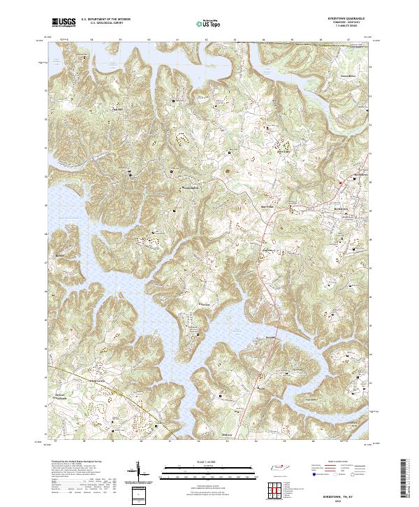
Byrdstown serves as the focal point of this Pickett County landscape, anchored by the Pickett County Courthouse. The area is characterized by the expansive reaches of Dale Hollow Lake, which winds through the terrain forming intricate peninsulas and landings such as Pryor Bend and Amonette Bend. Small communities and family-named localities like Love Lady, Star Point, and Smyrna are connected by a network of winding roads, including Star Point Rd and Hatcher Hall Rd. For those researching local lineages, the map is densely populated with small family burial grounds and markers, including the specific Jehu Reeder Sr and Jr Gravesite and various others like Hatcher Hall Cem and Story Cem. The northern edge of the map tracks the Kentucky Tennessee state line and the Clinton Co Pickett Co boundary, illustrating the jurisdictional intersections along the Wolf River.
Find a feature on this map
162 named features on this map. Tap any name to fly to it.
Don’t see what you’re looking for? This feature index may not catch every label — zoom into the map to look around manually.
Map Details
Editions of this 2022 Byrdstown Map
This is the sole edition of this map. No revisions or reprints were ever made.
Historical Maps of Faix Through Time
3 maps found