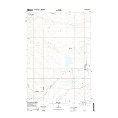
2015 Map of Byron
USGS Topo · Published 2015About this map
The town of Byron serves as the focal point of this Big Horn Basin landscape, situated north of the meandering Shoshone River. The 2015 survey reveals an intricate irrigation network essential to this arid region, featuring the Sidon Canal and Elk Lovell Canal which support local agriculture. This infrastructure, coupled with smaller watercourses like Bitter Creek and Lateral W, demonstrates the sustained effort to manage water resources in the northern Wyoming plains.
Find a feature on this map
33 named features on this map. Tap any name to fly to it.
Don’t see what you’re looking for? This feature index may not catch every label — zoom into the map to look around manually.
Map Details
Editions of this 2015 Byron Map
This is the sole edition of this map. No revisions or reprints were ever made.
Other maps of this area

1955 · Cody
USGS Topo · 1:250,000

1958 · Cody
USGS Topo · 1:250,000

1962 · Cody
USGS Topo · 1:250,000

1966 · Gilmore Hill NE
USGS Topo · 1:24,000

1966 · Frannie
USGS Topo · 1:24,000

1966 · Garland
USGS Topo · 1:24,000

1966 · Cowley
USGS Topo · 1:24,000

1966 · Deaver Reservoir
USGS Topo · 1:24,000

1966 · Jack Horner Reservoir
USGS Topo · 1:24,000

1966 · Gilmore Hill NW
USGS Topo · 1:24,000