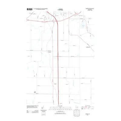
2013 Map of Byron
USGS Topo · Published 2013About this map
The E Br Fond Du Lac River and W Br Milwaukee River anchor this topographic view of Fond du Lac County, Wisconsin. The landscape is characterized by the agricultural and residential corridors that connect the historic settlements of Byron, South Byron, Hamilton, and Marblehead. Near the northern edge, Devils Lake and DeNeveu Lake provide distinct geographic landmarks alongside the Rolling Meadows Golf Course. This survey captures the region as its primary arteries, including Us-151 and Us-45, intersect with the local road network. The map preserves the names of numerous creek systems such as De Neveu Cr, Parsons Cr, and Kummel Cr, illustrating the drainage patterns that have shaped land use from early settlement through the modern era.
Find a feature on this map
70 named features on this map. Tap any name to fly to it.
Don’t see what you’re looking for? This feature index may not catch every label — zoom into the map to look around manually.
Map Details
Editions of this 2013 Byron Map
This is the sole edition of this map. No revisions or reprints were ever made.
Other maps of this area

1910 · Fond du Lac
USGS Topo · 1:62,500

1955 · Waupun
USGS Topo · 1:62,500

1955 · Campbellsport
USGS Topo · 1:62,500

1955 · Fond Du Lac
USGS Topo · 1:62,500

1955 · Fond Du Lac
USGS Topo · 1:24,000

1956 · Rosendale
USGS Topo · 1:62,500

1957 · Madison
USGS Topo · 1:250,000

1960 · Madison
USGS Topo · 1:250,000
1974 · St. Peter
USGS Topo · 1:24,000
1974 · Campbellsport
USGS Topo · 1:24,000