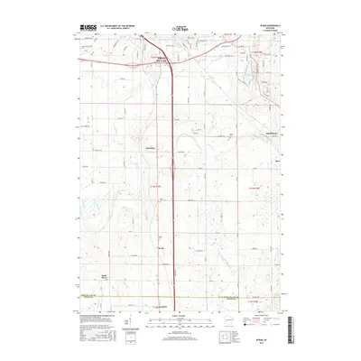
2015 Map of Byron
USGS Topo · Published 2015About this map
The agricultural heartland of Fond du Lac County is revealed in this 2015 study, dominated by the rolling topography of the Kettle Moraine region and a network of small, historic crossroads communities. Settlement patterns are anchored by several distinct villages, including Eden, Marblehead, and Hamilton, while the village of Byron serves as a central waypoint. The map provides significant detail for genealogists, identifying established burial grounds such as Hamilton Oak Grove Cem and Saint Johns Cem that suggest the long-standing presence of local farming families. The landscape is defined by its glacial hydrology, with the headwaters of the W Br Milwaukee River and De Neveu Cr draining the fields. These watercourses, along with Lake De Neveu, provided the essential resources that supported the early growth of this dairy-focused region of Wisconsin.
Find a feature on this map
87 named features on this map. Tap any name to fly to it.
Don’t see what you’re looking for? This feature index may not catch every label — zoom into the map to look around manually.
Map Details
Editions of this 2015 Byron Map
This is the sole edition of this map. No revisions or reprints were ever made.
Other maps of this area

1910 · Fond du Lac
USGS Topo · 1:62,500

1955 · Waupun
USGS Topo · 1:62,500

1955 · Campbellsport
USGS Topo · 1:62,500

1955 · Fond Du Lac
USGS Topo · 1:62,500

1955 · Fond Du Lac
USGS Topo · 1:24,000

1956 · Rosendale
USGS Topo · 1:62,500

1957 · Madison
USGS Topo · 1:250,000

1960 · Madison
USGS Topo · 1:250,000
1974 · St. Peter
USGS Topo · 1:24,000
1974 · Campbellsport
USGS Topo · 1:24,000