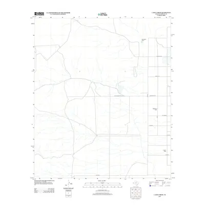
2013 Map of C And L Draw
USGS Topo · Published 2013About this map
C and L Draw defines the drainage patterns of this arid Hudspeth County landscape, where water management is central to the land's utility. The presence of Lake Tank and Jones Tank highlights the ranching infrastructure necessary for survival in this part of West Texas. This 2013 survey illustrates a transition from traditional ranching to more modern access, with Farm-To-Market Road 2249 and Ranch Road 2249 cutting through the open country. Local history and family ties are evident in the naming of the road network, which includes Jones Ranch Rd, Guitar Rd, and Lutrick Rd. The terrain is characterized by broad ephemeral washes like Washburn Draw and Cornudas Draw, which dictate the placement of buildings and rural routes across the high desert floor.
Find a feature on this map
15 named features on this map. Tap any name to fly to it.
Don’t see what you’re looking for? This feature index may not catch every label — zoom into the map to look around manually.
Map Details
Editions of this 2013 C And L Draw Map
This is the sole edition of this map. No revisions or reprints were ever made.
Other maps of this area

1951 · Dell City
USGS Topo · 1:62,500

1954 · Carlsbad
USGS Topo · 1:250,000

1954 · Van Horn
USGS Topo · 1:250,000

1955 · Cerro Diablo
USGS Topo · 1:62,500

1958 · Van Horn
USGS Topo · 1:250,000

1958 · Carlsbad
USGS Topo · 1:250,000
1969 · Culp Draw
USGS Topo · 1:24,000
1970 · Shiloh Hills SE
USGS Topo · 1:24,000
1970 · Mc Veigh Hills
USGS Topo · 1:24,000

1979 · Crow Flats
USGS Topo · 1:100,000