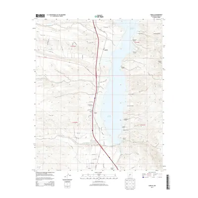
2013 Map of Caballo
USGS Topo · Published 2013About this map
Caballo Reservoir dominates the eastern half of this Sierra County landscape, where the waters of the Rio Grande are impounded against the western slopes of the Caballo Mountains. This 2013 survey illustrates the modern transportation and irrigation infrastructure that defines the region, centered on the Caballo Lake Interchange and the primary corridor of NM-187. Along this route, the small settlements of Oasis and Caballo sit above the shoreline, providing a clear look at local property divisions and road networks like Percha Rd and Chavez Rd.
Find a feature on this map
64 named features on this map. Tap any name to fly to it.
Don’t see what you’re looking for? This feature index may not catch every label — zoom into the map to look around manually.
Map Details
Editions of this 2013 Caballo Map
This is the sole edition of this map. No revisions or reprints were ever made.
Other maps of this area

1954 · Tularosa
USGS Topo · 1:250,000

1955 · Las Cruces
USGS Topo · 1:250,000

1958 · Las Cruces
USGS Topo · 1:250,000

1958 · Tularosa
USGS Topo · 1:250,000

1959 · Engle
USGS Topo · 1:62,500

1959 · Upham
USGS Topo · 1:62,500

1961 · Skute Stone Arroyo
USGS Topo · 1:24,000

1961 · Saladone Tank
USGS Topo · 1:24,000

1961 · Caballo
USGS Topo · 1:24,000

1961 · Clark Spring Canyon
USGS Topo · 1:24,000