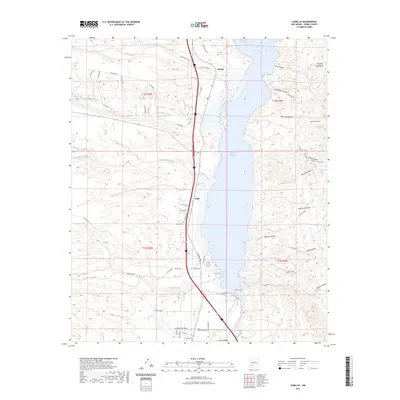
2023 Map of Caballo
USGS Topo · Published 2023About this map
Caballo Reservoir dominates this landscape, held by dammed waters that submerged parts of the Rio Grande valley. Along its western shore, the small settlement of Oasis and the Caballo Cem sit near the base of intricate drainage networks including Las Animas Creek and Percha Creek. The topography is sharply defined by the transition from the high desert arroyos and canyons to the east, such as Bat Cave Canyon and Apache Canyon, which descend from the Caballo Mountains.
Find a feature on this map
62 named features on this map. Tap any name to fly to it.
Don’t see what you’re looking for? This feature index may not catch every label — zoom into the map to look around manually.
Map Details
Editions of this 2023 Caballo Map
This is the sole edition of this map. No revisions or reprints were ever made.
Other maps of this area

1954 · Tularosa
USGS Topo · 1:250,000

1955 · Las Cruces
USGS Topo · 1:250,000

1958 · Las Cruces
USGS Topo · 1:250,000

1958 · Tularosa
USGS Topo · 1:250,000

1959 · Engle
USGS Topo · 1:62,500

1959 · Upham
USGS Topo · 1:62,500

1961 · Skute Stone Arroyo
USGS Topo · 1:24,000

1961 · Saladone Tank
USGS Topo · 1:24,000

1961 · Caballo
USGS Topo · 1:24,000

1961 · Clark Spring Canyon
USGS Topo · 1:24,000