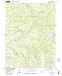
1980 Map of Cabin Creek
USGS Topo · Published 1985About this map
The Arapaho National Forest dominates this mountain landscape, defined by a dense network of drainages and high-altitude terrain. Recorded during a 1970s survey and published in the early 1980s, the map reveals a wilderness largely shaped by its watercourses. The confluence of Willow Creek and Gold Run in the northeast serves as a focal point for the local geography, while the North Fork Cabin Creek carves through the central portion of the quadrangle. A primary Jeep Trail provides the limited overland access through the steep grades, crossing Water Creek as it moves through the southern sections. Names like McQueary Creek and Sheriff Creek suggest the early ranching and local history of Grand County, reflecting the family-named landmarks common to the Colorado high country before modern development changed these drainages.
Find a feature on this map
18 named features on this map. Tap any name to fly to it.
Don’t see what you’re looking for? This feature index may not catch every label — zoom into the map to look around manually.
Map Details
Editions of this 1980 Cabin Creek Map
3 editions found
Other maps of this area

1915 · Longs Peak
USGS Topo · 1:125,000

1919 · Rocky Mountain National Park
USGS Topo · 1:125,000

1954 · Greeley
USGS Topo · 1:250,000

1954 · Craig
USGS Topo · 1:250,000

1956 · Radial Mountain
USGS Topo · 1:24,000

1956 · Parkview Mountain
USGS Topo · 1:24,000

1956 · Rand
USGS Topo · 1:62,500

1957 · Craig
USGS Topo · 1:250,000

1957 · Greeley
USGS Topo · 1:250,000

1957 · Bowen Mountain
USGS Topo · 1:24,000