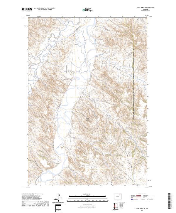
2023 Map of Cabin Creek SE
USGS Topo · Published 2023About this map
Powder River meanders through this Sheridan and Campbell County borderland, defining a landscape marked by erosional features like the Powder River Breaks. The terrain is shaped by an intricate network of drainage systems, including Clear Creek and Spotted Horse Creek, which feed into the main river valley. Along the western edge, the Kendrick Canal indicates the region's managed water infrastructure, supporting the agricultural needs of the valley floor below the L Quarter Circle Hills. Sparse infrastructure like Lower Powder River Rd provides the primary access through this dissected prairie. The convergence of numerous named draws and creeks, such as Lynn Draw and Joe Creek, highlights the complex hydrology of this high plains environment during the early twenty-first century.
Find a feature on this map
21 named features on this map. Tap any name to fly to it.
Don’t see what you’re looking for? This feature index may not catch every label — zoom into the map to look around manually.
Map Details
Editions of this 2023 Cabin Creek SE Map
This is the sole edition of this map. No revisions or reprints were ever made.
Other maps of this area

1954 · Gillette
USGS Topo · 1:250,000

1955 · Sheridan
USGS Topo · 1:250,000

1955 · Gillette
USGS Topo · 1:250,000

1958 · Gillette
USGS Topo · 1:250,000

1958 · Sheridan
USGS Topo · 1:250,000

1962 · Gillette
USGS Topo · 1:250,000

1962 · Sheridan
USGS Topo · 1:250,000

1971 · Larey Draw
USGS Topo · 1:24,000

1971 · Cabin Creek NW
USGS Topo · 1:24,000

1971 · Cabin Creek SE
USGS Topo · 1:24,000