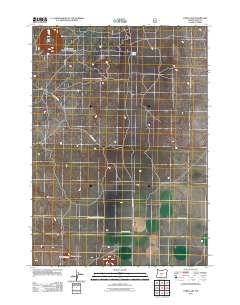
2011 Map of Cabin Lake
USGS Topo · Published 2011About this map
Flat Top and the surrounding volcanic landscape of Lake County define this high-desert region as documented in 2011. The geography is marked by distinctive geological formations such as Negroheel Butte and Reub Long Butte, which rise above the sagebrush-covered plains. This area is historically significant as part of the Oregon Outback, characterized by its wide-open spaces and the volcanic history that shaped the Fort Rock basin.
Find a feature on this map
30 named features on this map. Tap any name to fly to it.
Don’t see what you’re looking for? This feature index may not catch every label — zoom into the map to look around manually.
Map Details
Editions of this 2011 Cabin Lake Map
This is the sole edition of this map. No revisions or reprints were ever made.
Other maps of this area

1931 · Newberry Crater
USGS Topo · 1:125,000

1935 · Newberry Crater
USGS Topo · 1:125,000

1955 · Crescent
USGS Topo · 1:250,000

1957 · Crescent
USGS Topo · 1:250,000

1958 · Crescent
USGS Topo · 1:250,000

1970 · Crescent
USGS Topo · 1:250,000

1979 · Crescent
USGS Topo · 1:100,000

1981 · Cougar Mtn
USGS Topo · 1:24,000
1981 · Fort Rock
USGS Topo · 1:24,000
1981 · Cabin Lake
USGS Topo · 1:24,000