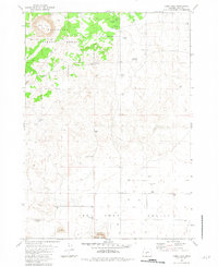
1981 Map of Cabin Lake
USGS Topo · Published 1982About this map
Cabin Lake Station serves as a focal point for this high-desert landscape in northern Lake County, situated on the edge of the Deschutes National Forest. The map documents a territory defined by volcanic geography and the critical necessity of water management, evidenced by the numerous named wells distributed across the arid Fort Rock Valley. Features such as Flat Top and Pasture Rock provide essential landmarks for navigation in the open basin, while Roub Long Cave suggests the subterranean complexity of the region's lava tube systems.
Find a feature on this map
25 named features on this map. Tap any name to fly to it.
Don’t see what you’re looking for? This feature index may not catch every label — zoom into the map to look around manually.
Map Details
Editions of this 1981 Cabin Lake Map
This is the sole edition of this map. No revisions or reprints were ever made.
Other maps of this area

1931 · Newberry Crater
USGS Topo · 1:125,000

1935 · Newberry Crater
USGS Topo · 1:125,000

1955 · Crescent
USGS Topo · 1:250,000

1957 · Crescent
USGS Topo · 1:250,000

1958 · Crescent
USGS Topo · 1:250,000

1970 · Crescent
USGS Topo · 1:250,000

1979 · Crescent
USGS Topo · 1:100,000

1981 · Cougar Mtn
USGS Topo · 1:24,000
1981 · Fort Rock
USGS Topo · 1:24,000
1982 · Schaub Lake
USGS Topo · 1:24,000