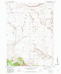
1982 Map of Schaub Lake
USGS Topo · Published 1982About this map
Fort Rock Valley defines this arid landscape, where the flat basin floor is punctuated by specialized ranching infrastructure and localized volcanic terrain. The 1982 map reveals a reliance on groundwater, documented through numerous labels for a well or substation, and larger operations like Poplars Well Ranch. These water points were critical for sustaining life in a region where surface water is ephemeral, appearing as seasonal features like Schaub Lake, Dog Lake, and Windmill Lake.
Find a feature on this map
30 named features on this map. Tap any name to fly to it.
Don’t see what you’re looking for? This feature index may not catch every label — zoom into the map to look around manually.
Map Details
Editions of this 1982 Schaub Lake Map
This is the sole edition of this map. No revisions or reprints were ever made.
Other maps of this area

1955 · Crescent
USGS Topo · 1:250,000

1957 · Crescent
USGS Topo · 1:250,000

1958 · Crescent
USGS Topo · 1:250,000

1968 · Silver Lake
USGS Topo · 1:24,000

1970 · Crescent
USGS Topo · 1:250,000

1979 · Crescent
USGS Topo · 1:100,000

1981 · Hogback Butte
USGS Topo · 1:24,000

1981 · Cougar Mtn
USGS Topo · 1:24,000

1981 · Thorn Lake
USGS Topo · 1:24,000

1981 · Lane Lake
USGS Topo · 1:24,000