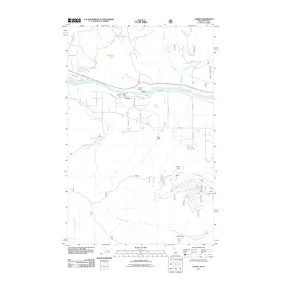
2011 Map of Cabinet
USGS Topo · Published 2011About this map
The Clark Fork river dominates this landscape on the Idaho-Montana border, cutting through the dramatic Cabinet Gorge. Near the small settlement of Cabinet, the infrastructure of the river's utility and conservation is evident through the Cabinet Dam Viewpoint and the twin operations of the Clark Fork Fish Hatchery and Cabinet Gorge Hatchery. The terrain transitions sharply from the river valley to high-elevation landmarks such as Beaver Peak and the sprawling Elk Ridge. This 2011 survey documents a network of Forest Service roads including NFD 2295 Rd and NFD 208 Rd that provide access to remote drainages like West Fork Elk Creek and Silta Draw. To the north, the isolated waters of Schlicht Lake sit tucked away from the main river corridor, while the drainage of Blue Creek and its East Fork carve through the northeastern timberlands.
Find a feature on this map
40 named features on this map. Tap any name to fly to it.
Don’t see what you’re looking for? This feature index may not catch every label — zoom into the map to look around manually.
Map Details
Editions of this 2011 Cabinet Map
This is the sole edition of this map. No revisions or reprints were ever made.
Other maps of this area

1909 · Cataldo
USGS Topo · 1:125,000

1911 · Cataldo
USGS Topo · 1:125,000

1911 · Priest Lake
USGS Topo · 1:250,000

1913 · Priest Lake
USGS Topo · 1:250,000

1920 · Libby
USGS Topo · 1:125,000

1930 · Libby
USGS Topo · 1:125,000

1932 · Libby
USGS Topo · 1:125,000

1932 · Trout Creek
USGS Topo · 1:125,000

1935 · Trout Creek
USGS Topo · 1:125,000

1936 · Trout Creek
USGS Topo · 1:125,000