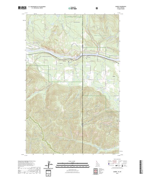
2024 Map of Cabinet
USGS Topo · Published 2024About this map
The Clark Fork river bisects this mountain landscape at the boundary of Kaniksu National Forest and Coeur d'Alene National Forest. The settlement of Cabinet sits on the southern bank near the Cabinet Cem, while the community of Heron is positioned further east. This area is defined by the significant hydroelectric infrastructure of the Cabinet Gorge Reservoir and the Cabinet Gorge itself, where the river carves through the terrain between the Cabinet Mountains and the Coeur d'Alene Mountains. Local transportation history is visible in the alignment of the Kootenai Cabinet Wagon Rd and various forest roads. The map reveals a high-relief environment punctuated by landmarks such as Beaver Peak and Delyle Ridge, with drainage systems like Blue Creek and Dry Creek feeding into the main river valley.
Find a feature on this map
74 named features on this map. Tap any name to fly to it.
Don’t see what you’re looking for? This feature index may not catch every label — zoom into the map to look around manually.
Map Details
Editions of this 2024 Cabinet Map
This is the sole edition of this map. No revisions or reprints were ever made.
Other maps of this area

1909 · Cataldo
USGS Topo · 1:125,000

1911 · Cataldo
USGS Topo · 1:125,000

1911 · Priest Lake
USGS Topo · 1:250,000

1913 · Priest Lake
USGS Topo · 1:250,000

1920 · Libby
USGS Topo · 1:125,000

1930 · Libby
USGS Topo · 1:125,000

1932 · Libby
USGS Topo · 1:125,000

1932 · Trout Creek
USGS Topo · 1:125,000

1935 · Trout Creek
USGS Topo · 1:125,000

1936 · Trout Creek
USGS Topo · 1:125,000