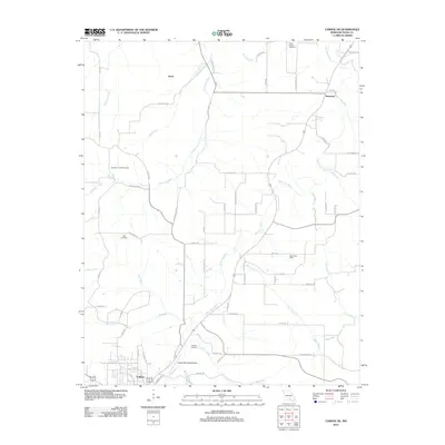
2012 Map of Cabool NE
USGS Topo · Published 2012About this map
The Big Piney River and its numerous tributaries, including Hamilton Creek and Berry Branch, dominate this landscape north and east of Cabool. This 2012 survey reveals a rural network of homesteads and small communities like Simmons and Hurst, connected by a web of local roads such as Bado Rd and Cloverdale Rd. Genealogists will find significant value in the documentation of several burial grounds, including the Hamilton Creek Cemetery, Altis Cemetery, and Rocky Branch Cemetery, providing a spatial record of the area's family histories. The presence of the David Post Office and the Cabool Memorial Airport indicates the infrastructure supporting these Ozark Plateau settlements. The map's detail also tracks smaller watercourses like Opossum Creek and the Dry Fork, illustrating the intricate drainage patterns that have historically shaped land use and agricultural boundaries in this part of Texas County.
Find a feature on this map
64 named features on this map. Tap any name to fly to it.
Don’t see what you’re looking for? This feature index may not catch every label — zoom into the map to look around manually.
Map Details
Editions of this 2012 Cabool NE Map
This is the sole edition of this map. No revisions or reprints were ever made.
Other maps of this area

1941 · Bado
USGS Topo · 1:62,500

1943 · Bado
USGS Topo · 1:62,500

1945 · Clear Springs
USGS Topo · 1:62,500

1948 · Clear Springs
USGS Topo · 1:62,500

1949 · Rolla
USGS Topo · 1:250,000

1950 · Cabool SW
USGS Topo · 1:24,000

1951 · Cabool SE
USGS Topo · 1:24,000

1951 · Houston
USGS Topo · 1:24,000

1951 · Cabool NW
USGS Topo · 1:24,000

1951 · Cabool NE
USGS Topo · 1:24,000