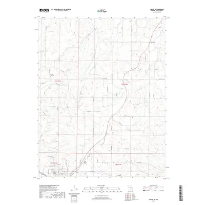
2017 Map of Cabool NE
USGS Topo · Published 2017About this map
The Big Piney River meanders through the eastern portion of this Texas County landscape, serving as a primary drainage for numerous tributaries like Hamilton Cr and Bear Cr. In the south, the city of Cabool serves as a regional anchor, with its northern residential streets and the Cabool Memorial Airport clearly defined. This 2017 survey details a rural area where life remains tied to the local land and family history, evident in the scattering of several burial grounds such as Hamilton Creek Cem, Altis Cem, and Hamilton Cem. Further north, the settlement of Simmons sits along the highway corridor. The map shows a complex network of county roads including Bado Rd and Shady Grove Rd that link these small communities and rural homesteads across the varied terrain of the Ozarks.
Find a feature on this map
81 named features on this map. Tap any name to fly to it.
Don’t see what you’re looking for? This feature index may not catch every label — zoom into the map to look around manually.
Map Details
Editions of this 2017 Cabool NE Map
This is the sole edition of this map. No revisions or reprints were ever made.
Other maps of this area

1941 · Bado
USGS Topo · 1:62,500

1943 · Bado
USGS Topo · 1:62,500

1945 · Clear Springs
USGS Topo · 1:62,500

1948 · Clear Springs
USGS Topo · 1:62,500

1949 · Rolla
USGS Topo · 1:250,000

1950 · Cabool SW
USGS Topo · 1:24,000

1951 · Cabool SE
USGS Topo · 1:24,000

1951 · Houston
USGS Topo · 1:24,000

1951 · Cabool NW
USGS Topo · 1:24,000

1951 · Cabool NE
USGS Topo · 1:24,000