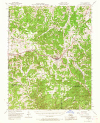
1951 Map of Cabool
USGS Topo · Published 1967About this map
Cabool serves as a central hub on this mid-century survey, situated at the junction of the St Louis and San Francisco RR and major regional roadways. The landscape is defined by the intersection of four counties—Wright, Texas, Douglas, and Howell—and the sprawling tracts of the Mark Twain National Forest to the south. This era reveals a high density of rural institutions, particularly many neighborhood schools like Simmons School and Gravel Point School, several of which are already noted as abandoned, such as Gum Spring School and Excelsior School.
Find a feature on this map
88 named features on this map. Tap any name to fly to it.
Don’t see what you’re looking for? This feature index may not catch every label — zoom into the map to look around manually.
Map Details
Editions of this 1951 Cabool Map
2 editions found

Other maps of this area

1931 · Manes
USGS Topo · 1:48,000

1937 · Buckhart
USGS Topo · 1:48,000

1939 · Topaz
USGS Topo · 1:62,500

1941 · Topaz
USGS Topo · 1:62,500

1941 · Manes
USGS Topo · 1:62,500

1941 · Bado
USGS Topo · 1:62,500

1943 · Manes
USGS Topo · 1:62,500

1943 · Bado
USGS Topo · 1:62,500

1943 · Buckhart
USGS Topo · 1:62,500

1945 · Harrison
USGS Topo · 1:250,000