
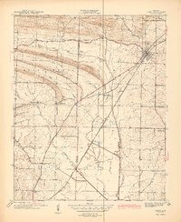
1941 Map of Cabot
USGS Topo · Published 1945About this map
Bacon Ridge and the Missouri Mountains dominate the northwestern landscape of this Arkansas survey, conducted just before the United States entered the second World War. This detailed study, sponsored by the Arkansas Geological Survey and mapped by the U.S. Geological Survey, provides a precise record of the transition from the rugged ridges down into the flatlands of Caroline and Goodrum townships. The Missouri Pacific railroad serves as the primary artery for the town of Cabot, while smaller rural settlements like Holland are connected by a network of local thoroughfares including McKenzie Road and Tate Road. The area is densely punctuated by country churches and community centers, from Mt Carmel Ch in the east to Ebenezer Ch and Bayou Meto Ch in the south, reflecting a well-established social fabric tied to the land and the local waters of Two Prairie Bayou.
Find a feature on this map
30 named features on this map. Tap any name to fly to it.
Don’t see what you’re looking for? This feature index may not catch every label — zoom into the map to look around manually.
Map Details
Editions of this 1941 Cabot Map
2 editions found
Other maps of this area

1891 · Little Rock
USGS Topo · 1:125,000

1893 · Little Rock
USGS Topo · 1:125,000

1935 · Mc Almont
USGS Topo · 1:24,000

1940 · Lonoke
USGS Topo · 1:62,500

1941 · Olmstead
USGS Topo · 1:31,680

1943 · Jacksonville
USGS Topo · 1:31,680

1948 · Helena
USGS Topo · 1:250,000

1949 · Lonoke
USGS Topo · 1:62,500

1950 · Helena
USGS Topo · 1:250,000

1950 · Lonoke
USGS Topo · 1:62,500