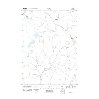
2012 Map of Cabot
USGS Topo · Published 2012About this map
The Winooski River carves a central path through this Vermont landscape, anchoring the valley where settlements like Lower Cabot and the rural crossroads of South Walden are situated. This 2012 survey reveals a classic New England pattern of upland farming and water-powered history, evidenced by the numerous cemeteries including Cabot Village Cem and Durant Cem that dot the hillsides. The terrain is defined by dramatic local landmarks such as Nichols Ledge overlooking the waters of Nichols Pond, while smaller basins like Coits Pond and Lyford Pond pocket the high ground.
Find a feature on this map
116 named features on this map. Tap any name to fly to it.
Don’t see what you’re looking for? This feature index may not catch every label — zoom into the map to look around manually.
Map Details
Editions of this 2012 Cabot Map
This is the sole edition of this map. No revisions or reprints were ever made.
Other maps of this area

1928 · Hardwick
USGS Topo · 1:62,500

1934 · Hardwick
USGS Topo · 1:48,000

1935 · Lyndonville
USGS Topo · 1:48,000

1938 · Hardwick
USGS Topo · 1:62,500

1938 · St. Johnsbury
USGS Topo · 1:48,000

1939 · Lyndonville
USGS Topo · 1:62,500

1939 · Plainfield
USGS Topo · 1:48,000

1940 · Plainfield
USGS Topo · 1:62,500

1943 · Plainfield
USGS Topo · 1:62,500

1943 · St. Johnsbury
USGS Topo · 1:62,500