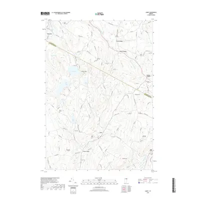
2018 Map of Cabot
USGS Topo · Published 2018About this map
The upper reaches of the Winooski River define the valley floor where the villages of Cabot and Lower Cabot took root. This 2018 survey details the transition from the river's edge to the high elevations of Nichols Ledge and Danville Hill. Historically significant routes, most notably Bayley Hazen Rd, cut across the terrain, reflecting the early military and commercial infrastructure of the region. The landscape is dotted with family and community burial grounds, including the Cabot Village Cem and the remote Folsom Cem. The presence of small water bodies like Nichols Pond and East Long Pond alongside modern features such as Catamount Airfield illustrates the enduring rural character of this part of Caledonia and Washington Counties. Local researchers can trace the old road networks that connected disparate settlements like Walden Heights and Taylor Bridge through the highlands.
Find a feature on this map
102 named features on this map. Tap any name to fly to it.
Don’t see what you’re looking for? This feature index may not catch every label — zoom into the map to look around manually.
Map Details
Editions of this 2018 Cabot Map
This is the sole edition of this map. No revisions or reprints were ever made.
Other maps of this area

1928 · Hardwick
USGS Topo · 1:62,500

1934 · Hardwick
USGS Topo · 1:48,000

1935 · Lyndonville
USGS Topo · 1:48,000

1938 · Hardwick
USGS Topo · 1:62,500

1938 · St. Johnsbury
USGS Topo · 1:48,000

1939 · Lyndonville
USGS Topo · 1:62,500

1939 · Plainfield
USGS Topo · 1:48,000

1940 · Plainfield
USGS Topo · 1:62,500

1943 · Plainfield
USGS Topo · 1:62,500

1943 · St. Johnsbury
USGS Topo · 1:62,500