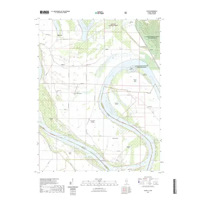
2021 Map of Cache
USGS Topo · Published 2021About this map
The Mississippi River carves a massive, looping course through this Illinois-Missouri borderland, creating a complex geography of river bends and islands. Small settlements like Miller City, Roth, Willard, and Cache are scattered across the floodplain of Alexander County, protected by an extensive levee system including the Mississippi Levee Rd. The presence of the Dogtooth Bend Mounds indicates a long history of human occupation in this fertile river bottom, while the Hunter Raffety Elevators Inc Airport speaks to the region's modern agricultural economy.
Find a feature on this map
54 named features on this map. Tap any name to fly to it.
Don’t see what you’re looking for? This feature index may not catch every label — zoom into the map to look around manually.
Map Details
Editions of this 2021 Cache Map
This is the sole edition of this map. No revisions or reprints were ever made.
Other maps of this area

1931 · Cairo
USGS Topo · 1:62,500

1933 · Cairo
USGS Topo · 1:62,500

1934 · Thebes
USGS Topo · 1:62,500

1939 · Wickliffe
USGS Topo · 1:62,500

1939 · Charleston
USGS Topo · 1:62,500

1939 · Cairo
USGS Topo · 1:62,500

1939 · Thebes
USGS Topo · 1:62,500

1949 · Paducah
USGS Topo · 1:250,000

1950 · Paducah
USGS Topo · 1:250,000

1952 · Wickliffe
USGS Topo · 1:62,500