
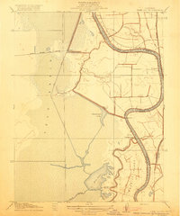
1916 Map of Cache Slough
USGS Topo · Published 1916About this map
The expansive Yolo Basin dominates this 1906 survey of the California Delta, revealing a landscape defined by an intricate network of waterways before modern reclamation projects fully transformed the region. In the northern sections, the Oakland Antioch and Eastern railroad cuts a straight line across the marshy terrain, providing a vital transport link through the northern Solano and Yolo county boundary.
Find a feature on this map
14 named features on this map. Tap any name to fly to it.
Don’t see what you’re looking for? This feature index may not catch every label — zoom into the map to look around manually.
Map Details
Editions of this 1916 Cache Slough Map
This is the sole edition of this map. No revisions or reprints were ever made.
Other maps of this area

1907 · Antioch
USGS Topo · 1:62,500

1908 · Vacaville
USGS Topo · 1:62,500

1908 · Courtland
USGS Topo · 1:62,500

1908 · Antioch
USGS Topo · 1:62,500

1910 · Rio Vista
USGS Topo · 1:31,680

1910 · Isleton
USGS Topo · 1:31,680

1916 · Dixon
USGS Topo · 1:31,680

1916 · Vorden
USGS Topo · 1:31,680

1916 · Maine Prairie
USGS Topo · 1:31,680
1916 · Babel Slough
USGS Topo · 1:31,680