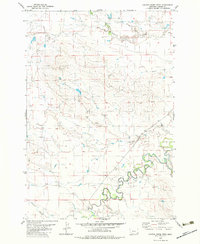
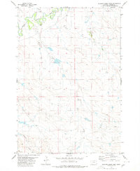
1980 Map of Cactus Creek West
USGS Topo · Published 1983About this map
The Little Missouri River meanders across the southeastern corner of this corner of Montana, creating a complex series of oxbows and bends that dominate the local drainage. Surveyed in the early 1970s, this landscape in Carter County is defined by its watercourses, including Cottonwood Creek in the north and the namesake Cactus Creek flowing through the central interior. A notable river crossing, simply labeled Ford, provides evidence of historical land use and early ranching-era travel patterns before more permanent infrastructure reached this stretch of the river. The topography is further marked by several seasonal streams such as Elkhorn Creek, Blacktail Creek, and Mud Creek. These features, along with bench marks like Bm 3263 and Bm 3272, offer precise reference points for researchers interested in the geographic evolution of the northern plains and the Carter County hinterlands.
Find a feature on this map
12 named features on this map. Tap any name to fly to it.
Don’t see what you’re looking for? This feature index may not catch every label — zoom into the map to look around manually.
Map Details
Editions of this 1980 Cactus Creek West Map
2 editions found
Other maps of this area

1954 · Ekalaka
USGS Topo · 1:250,000

1956 · Ekalaka
USGS Topo · 1:250,000

1958 · Ekalaka
USGS Topo · 1:250,000

1965 · Ekalaka
USGS Topo · 1:250,000

1980 · Cactus Creek West
USGS Topo · 1:24,000

1980 · Finger Buttes East
USGS Topo · 1:24,000
1980 · Albion
USGS Topo · 1:24,000
1980 · Elkhorn Creek East
USGS Topo · 1:24,000
1980 · Capitol NW
USGS Topo · 1:24,000
1980 · Elkhorn Creek West
USGS Topo · 1:24,000