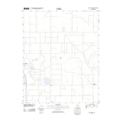
2010 Map of Cactus East
USGS Topo · Published 2010About this map
Cactus and the surrounding industrial and agricultural lands of Moore County are defined by a strict grid of section roads and water management features. The landscape is bisected by North Palo Duro Creek, which is interrupted by localized engineering including Petty Dam and the E M Gossett Dam. These structures create essential water bodies like Petty Lake in an otherwise arid region. The map reveals the layout of small rail-side settlements and industrial hubs such as Etter, Bryden, and Sheerin Junction, which are interconnected by state roads like FM 281. The presence of Nitrate RD and High Pockets RD suggests the proximity of chemical or agricultural processing facilities, common to this part of the Texas Panhandle. This survey provides a clear view of the infrastructure supporting the local economy during the first decade of the 21st century.
Find a feature on this map
21 named features on this map. Tap any name to fly to it.
Don’t see what you’re looking for? This feature index may not catch every label — zoom into the map to look around manually.
Map Details
Editions of this 2010 Cactus East Map
This is the sole edition of this map. No revisions or reprints were ever made.
Other maps of this area

1954 · Tucumcari
USGS Topo · 1:250,000

1954 · Perryton
USGS Topo · 1:250,000

1954 · Amarillo
USGS Topo · 1:250,000

1954 · Dalhart
USGS Topo · 1:250,000

1958 · Perryton
USGS Topo · 1:250,000

1958 · Amarillo
USGS Topo · 1:250,000

1958 · Tucumcari
USGS Topo · 1:250,000

1958 · Dalhart
USGS Topo · 1:250,000

1962 · Dalhart
USGS Topo · 1:250,000

1963 · Cactus East
USGS Topo · 1:24,000