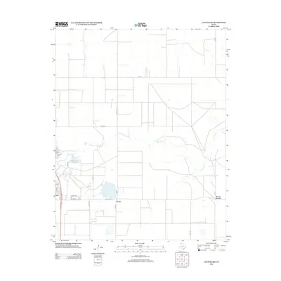
2012 Map of Cactus East
USGS Topo · Published 2012About this map
Etter and the nearby rail-aligned community of Bryden anchor this 2012 survey of the Texas Panhandle landscape. The area is defined by its rectilinear road network, including the intersection of Us-287 and Ranch Road 281, which serves as a vital corridor through Moore County. The natural geography is marked by the winding course of N Palo Duro Cr, which meanders eastward toward Sheerin Junction, creating a distinct break in the surrounding agricultural grid. Smaller water features like Petty Lake provide local landmarks in a region largely dedicated to ranching and transport. The map also reveals the localized street plan of Etter, with named thoroughfares such as Montana Dr and Texas St reflecting the town's domestic layout alongside industrial routes like Nitrate Rd.
Find a feature on this map
29 named features on this map. Tap any name to fly to it.
Don’t see what you’re looking for? This feature index may not catch every label — zoom into the map to look around manually.
Map Details
Editions of this 2012 Cactus East Map
This is the sole edition of this map. No revisions or reprints were ever made.
Other maps of this area

1954 · Tucumcari
USGS Topo · 1:250,000

1954 · Perryton
USGS Topo · 1:250,000

1954 · Amarillo
USGS Topo · 1:250,000

1954 · Dalhart
USGS Topo · 1:250,000

1958 · Perryton
USGS Topo · 1:250,000

1958 · Amarillo
USGS Topo · 1:250,000

1958 · Tucumcari
USGS Topo · 1:250,000

1958 · Dalhart
USGS Topo · 1:250,000

1962 · Dalhart
USGS Topo · 1:250,000

1963 · Cactus East
USGS Topo · 1:24,000