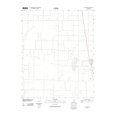
2010 Map of Cactus West
USGS Topo · Published 2010About this map
North Palo Duro Creek carves a winding path through the High Plains of Moore County, providing a stark geographic contrast to the rigid grid of rural farm roads that define this landscape. In the eastern portion of the survey, the industrial and residential settlement of Cactus stands as a focal point, situated near the intersection of W Rd A and Schroeter Ave. To its south, the community of Etter marks a secondary node of activity along the corridor of FM 281. The map reveals a highly structured agricultural environment, where family and local heritage is preserved through thoroughfares like Gilliespies Rd and Johnson Rd. This 2010 rendering documents the intersection of rural watercourses and the persistent expansion of these specialized Panhandle communities.
Find a feature on this map
20 named features on this map. Tap any name to fly to it.
Don’t see what you’re looking for? This feature index may not catch every label — zoom into the map to look around manually.
Map Details
Editions of this 2010 Cactus West Map
This is the sole edition of this map. No revisions or reprints were ever made.
Other maps of this area

1954 · Tucumcari
USGS Topo · 1:250,000

1954 · Perryton
USGS Topo · 1:250,000

1954 · Amarillo
USGS Topo · 1:250,000

1954 · Dalhart
USGS Topo · 1:250,000

1958 · Perryton
USGS Topo · 1:250,000

1958 · Amarillo
USGS Topo · 1:250,000

1958 · Tucumcari
USGS Topo · 1:250,000

1958 · Dalhart
USGS Topo · 1:250,000

1962 · Dalhart
USGS Topo · 1:250,000

1963 · Cactus East
USGS Topo · 1:24,000