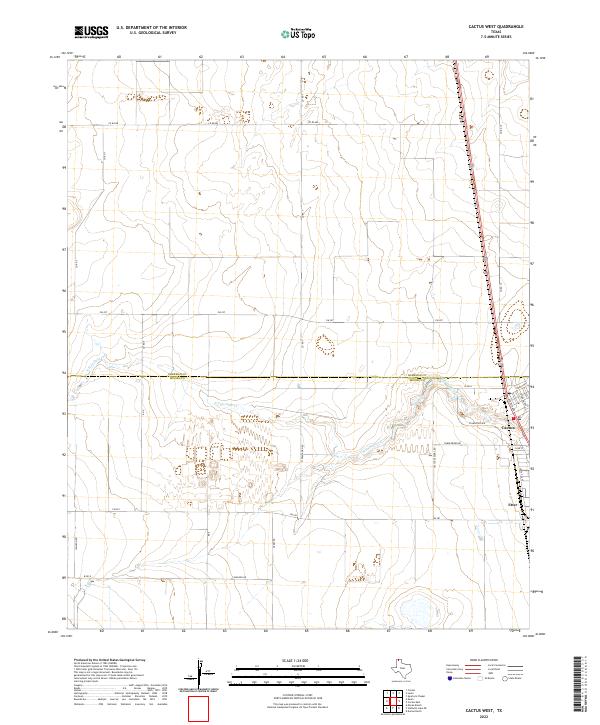
2022 Map of Cactus West
USGS Topo · Published 2022About this map
The northern High Plains landscape of the Texas Panhandle is defined by the sharp boundary between Sherman Co and Moore Co, where industrial and agricultural patterns converge. In the eastern portion of the sheet, the industrial hub of Cactus and the nearby settlement of Etter sit along the corridor of US Route 287. This area shows a transition from the grid-like regularity of rural road networks, such as FM 281 and Fm 297, to the specialized infrastructure of large-scale ranching and feedlot operations indicated by Cactus Feeders Rd and Tumbleweed Rd. Cutting through the center of this flat expanse is the N Palo Duro Cr, which provides the only significant topographic variation in an otherwise highly organized landscape. The local street names in Cactus, such as Ashton Ave and Graham Ave, offer a detailed view of the residential layout supporting the regional agricultural industry.
Find a feature on this map
26 named features on this map. Tap any name to fly to it.
Don’t see what you’re looking for? This feature index may not catch every label — zoom into the map to look around manually.
Map Details
Editions of this 2022 Cactus West Map
This is the sole edition of this map. No revisions or reprints were ever made.
Other maps of this area

1954 · Tucumcari
USGS Topo · 1:250,000

1954 · Perryton
USGS Topo · 1:250,000

1954 · Amarillo
USGS Topo · 1:250,000

1954 · Dalhart
USGS Topo · 1:250,000

1958 · Perryton
USGS Topo · 1:250,000

1958 · Amarillo
USGS Topo · 1:250,000

1958 · Tucumcari
USGS Topo · 1:250,000

1958 · Dalhart
USGS Topo · 1:250,000

1962 · Dalhart
USGS Topo · 1:250,000

1963 · Cactus East
USGS Topo · 1:24,000