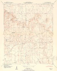
1950 Map of Caddo
USGS Topo · Published 1961About this map
Caddo serves as a central point of settlement in this Lawrence County landscape, where the Southern railroad line cuts through the northeastern corner near Fox Creek. The terrain is defined by dramatic elevations and depressions, notably Chicken Foot Mountain and Bates Mountain in the northwest, and the distinctive Goat Bluff overlooking the drainage of Mallard Creek. A network of small community institutions—ranging from the Morris Chapel and New Antioch Ch to the Midway Sch—illustrates a rural society organized around crossroads and local congregations. Geologic features such as the Ivy Hollow Cave and Penitentiary Hole suggest a karst landscape where water has carved into the limestone, creating natural landmarks like the Blowing Spring and Ready Spring. The distribution of family burial grounds, including the Clardy Cem and Vaughan Cem, provides a detailed record of local genealogy scattered across the ridges and hollows.
Find a feature on this map
81 named features on this map. Tap any name to fly to it.
Don’t see what you’re looking for? This feature index may not catch every label — zoom into the map to look around manually.
Map Details
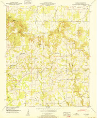
Editions of this 1950 Caddo Map
2 editions found
Other maps of this area

1935 · Moulton
USGS Topo · 1:24,000

1935 · Danville
USGS Topo · 1:48,000

1935 · Oakville
USGS Topo · 1:24,000

1936 · Caddo
USGS Topo · 1:24,000

1936 · Stewart Cross Roads
USGS Topo · 1:24,000

1936 · Courtland
USGS Topo · 1:24,000

1936 · Trinity
USGS Topo · 1:24,000

1936 · Hillsboro
USGS Topo · 1:24,000

1936 · Moulton
USGS Topo · 1:48,000

1936 · Masterson
USGS Topo · 1:24,000