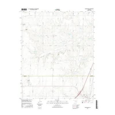
2016 Map of Caddo North
USGS Topo · Published 2016About this map
Caddo serves as a primary settlement at the edge of the Atoka Co Bryan Co line, where the landscape is defined by an extensive water management system along the Caney Cr drainage. Numerous numbered reservoirs, such as Caney Cr Site 14 Reservoir and Caney Cr Site 7 Reservoir, follow the winding path of the creek through the central and northern sections of the quadrangle. This infrastructure reflects the region's agricultural adaptation to the varied terrain between Buffalo Head and the southern lowland plains.
Find a feature on this map
57 named features on this map. Tap any name to fly to it.
Don’t see what you’re looking for? This feature index may not catch every label — zoom into the map to look around manually.
Map Details
Editions of this 2016 Caddo North Map
This is the sole edition of this map. No revisions or reprints were ever made.
Other maps of this area

1899 · Atoka
USGS Topo · 1:125,000

1900 · Atoka
USGS Topo · 1:125,000

1957 · Ardmore
USGS Topo · 1:250,000

1963 · Ardmore
USGS Topo · 1:250,000
1968 · Wapanucka South
USGS Topo · 1:24,000

1968 · Caddo NW
USGS Topo · 1:24,000
1968 · Durant North
USGS Topo · 1:24,000
1969 · Boggy Depot
USGS Topo · 1:24,000

1969 · Caddo North
USGS Topo · 1:24,000

1969 · Bokchito
USGS Topo · 1:24,000