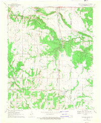
1968 Map of Wapanucka South
USGS Topo · Published 1971About this map
Wapanucka and the surrounding Johnston County landscape are bisected by the Kansas Oklahoma and Gulf Railroad, which defines the industrial and transit corridor of this region in the late 1960s. A notable historical marker on this sheet is the Old Indian Treaty Boundary, which runs north-to-south through the center of the survey area, separating the western reaches from the Wilson terrain to the east.
Find a feature on this map
22 named features on this map. Tap any name to fly to it.
Don’t see what you’re looking for? This feature index may not catch every label — zoom into the map to look around manually.
Map Details
Editions of this 1968 Wapanucka South Map
This is the sole edition of this map. No revisions or reprints were ever made.
Other maps of this area

1899 · Atoka
USGS Topo · 1:125,000

1900 · Atoka
USGS Topo · 1:125,000

1901 · Tishomingo
USGS Topo · 1:125,000

1957 · Ardmore
USGS Topo · 1:250,000

1963 · Ardmore
USGS Topo · 1:250,000

1967 · Connerville SE
USGS Topo · 1:24,000
1967 · Connerville NE
USGS Topo · 1:24,000
1967 · Milburn
USGS Topo · 1:24,000

1968 · Caddo NW
USGS Topo · 1:24,000
1969 · Boggy Depot
USGS Topo · 1:24,000