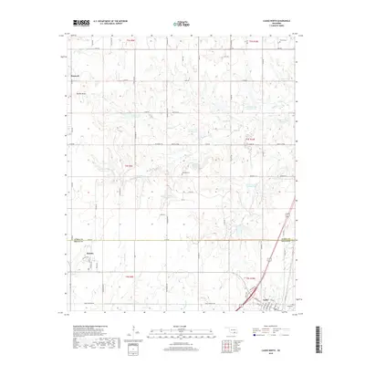
2018 Map of Caddo North
USGS Topo · Published 2018About this map
The border of Atoka and Bryan Counties runs through this Oklahoma landscape, where the town of Kenefic and the northern reaches of Caddo anchor the southern half of the sheet. The terrain is defined by an extensive water management system along Caney Creek, featuring numerous numbered reservoirs such as Caney Cr Site 11 and Site 4 Reservoir designed to control the local watershed. Historically significant sites are scattered throughout the rural sections, including Maytubby Cemetery near Maytubby Springs and Perkins Cemetery in the northeast corner. This 2018 survey reveals a network of section roads like Voca Road and Nails Crossing Road that overlay the traditional Public Land Survey System, while natural features like Buffalo Head and the winding Buffalo Creek provide a look at the original topography before modern hydraulic developments changed the flow of the land.
Find a feature on this map
50 named features on this map. Tap any name to fly to it.
Don’t see what you’re looking for? This feature index may not catch every label — zoom into the map to look around manually.
Map Details
Editions of this 2018 Caddo North Map
This is the sole edition of this map. No revisions or reprints were ever made.
Other maps of this area

1899 · Atoka
USGS Topo · 1:125,000

1900 · Atoka
USGS Topo · 1:125,000

1957 · Ardmore
USGS Topo · 1:250,000

1963 · Ardmore
USGS Topo · 1:250,000
1968 · Wapanucka South
USGS Topo · 1:24,000

1968 · Caddo NW
USGS Topo · 1:24,000
1968 · Durant North
USGS Topo · 1:24,000
1969 · Boggy Depot
USGS Topo · 1:24,000

1969 · Caddo North
USGS Topo · 1:24,000

1969 · Bokchito
USGS Topo · 1:24,000